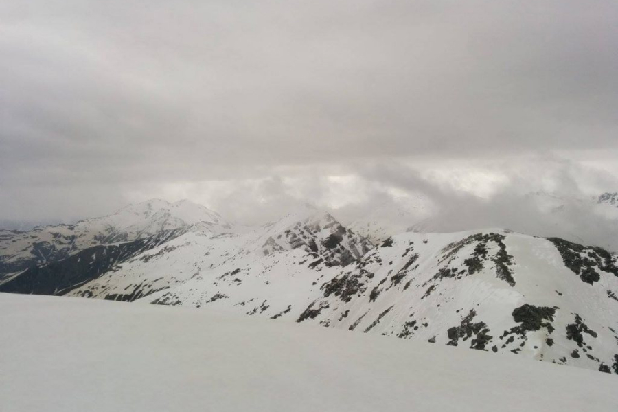
Musa Ka Musalla Tek
Nestled at 4080 meters, Musa Ka Musalla Tek stands at the confluence of the Siran and Kaghan Valleys, enveloped by Himalayan grandeur. Its name, "Moses' Mat," is intertwined with tales: one linking it to a local shepherd named Musa who prayed at the peak, while another whispers the association with the prophet Moses. At the summit lies a shrine, a mosaic of stones adorned with vibrant flags. However, its classification as a peak or plateau needs to be clarified. The trek's most common route, Munda Gucha, begins at Shinkiyari in the northern reaches of Manshera. From Munda Gucha village, trekkers initiate their journey, equipped with local guides and donkeys to navigate the mountain's paths and transport essential supplies like food and tents.
History of Musa Ka Musalla:
Musa Ka Musalla, perched at an altitude of 4080 meters and nestled at the confluence of the Siran and Kaghan Valleys in the Himalayas, holds a historical legacy steeped in diverse folklore. The name "Moses' Mat" is the subject of multiple tales, with some attributing it to a shepherd named Musa, said to have prayed on the peak, while others link it to the biblical figure of Moses. At the summit, a shrine made from various stones adorned with colorful flags adds to the mystical allure of the site. There's an ongoing debate about whether this site should be classified as a peak or a plateau. Trekkers often follow the traditional Munda Gucha Route, starting their journey from Shinkiyari in Manshera and progressing to Munda Gucha village, where they engage guides and donkeys to assist in transporting essential supplies like food and tents.
Musa Ka Musalla Tek weather: Best season to Undertake
is during the summer and early autumn, from June to September. During these months, the weather in the Himalayan region surrounding the confluence of the Siran and Kaghan Valleys is relatively stable and conducive to trekking. Clear skies, moderate temperatures, and lesser chances of snow or extreme cold make it an ideal period for hikers and adventurers to tackle the Musa Ka Musalla trail, ensuring safer and more comfortable trekking conditions.
Tour Detail:
Day 1: Arrival and Begin the Trek
- Arrive in Islamabad and then drive to Manda Gucha via Shinkiari.
Day 2: Trek from Manda Gucha to Khodi Meadow
- Manda Gucha to Jachha (3.2 kilometers) - approximately 34 minutes by Jeep.
- Jachha to Dhor Camp Site (4.8 kilometers) - approximately 1 hour 43 minutes on foot.
- Dhor to Jabbad Meadow (4.5 kilometers) - approximately 3 hours on foot.
- Jabbad Meadow to Khodi Meadow (2.1 kilometers) - approximately 1 hour 17 minutes on foot. Set camp at Khodi Meadow at an elevation of 2935 meters.
Day 3: Trek from Khodi Meadow to Summit
- Khodi Meadow to Gali (1.3 kilometers) - approximately 38 minutes on foot. Gali is at an elevation of 3175 meters.
- Gali to Pehli Ziyarat (3.8 kilometers) - approximately 3 hours 38 minutes on foot. Pehli Ziyarat is at an elevation of 3935 meters.
- Pehli Ziyarat to Summit (0.61 kilometers) - approximately 39 minutes on foot. Summit elevation is 4079 meters.
- Descend from Summit to Khodi Camp Site (5.7 kilometers) - approximately 4 hours downhill. Camp at Khodi Meadow.
Day 4: Descent and Return
- Khodi Meadow to Jachha (approximately 9 kilometers) - about 5 hours 30 minutes on foot. Return to Manda Gucha by Jeep and then drive back to Islamabad.
This detailed itinerary includes the estimated trekking times and daily distances for the Musa Ka Musalla trek.


